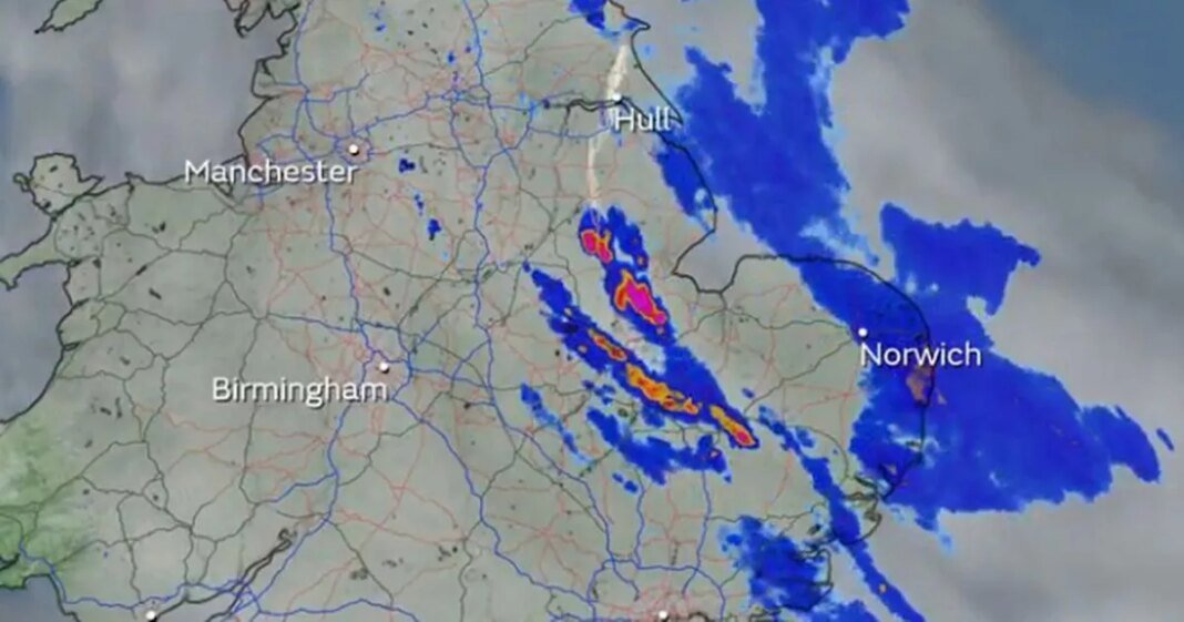
Despite the UK recording its warmest spring equinox in 50 years this week, “rare” thunder and flooding is on the way for much of the country, according to forecasters.
On Thursday, the Met Office revealed Northolt in London reached 21.3C and Chertsey in Surrey reached 21.3C, beating the previous high of 19.7C set earlier in March. The equinox marks the first day of astronomical spring.
Despite the warm spring weather, the National Highway had to close parts of the M18 in Yorkshire to clear floodwater on Saturday following heavy rain. Futhermore, the Environment Agency said flood alerts remain in place for 20 parts of the country including Henley, Salisbury and Hertfordshire.
The Environment Agency issues a flood warning when forecasts show that flooding is expected from: rivers, heavy rain that will cause rivers to flash flood, high tides and surges coupled with strong winds at sea. The Met Office also advised people to “take care” as “there could be some localised flooding in places”.
These storms are “rare” due to the warm weather of late, according to Jonathan Vautrey, a meteorologist at the Met Office, who added: “For this time in the year, it is rarer to have such intense storms. This is happening because we have had a lot of warm weather of late and temperatures are notably above average for the time of year. We’ve had highs reaching over 20C over the last few days, and we were up to 18.5C as the high today as well, where we should be more around 10 or 11C. Heavy, thundery showers continue in parts of London and the East Midlands, with some areas seeing 10-15mm of rain in less than an hour.
“That sort of heat that we’ve got around at the moment has really helped to spark off some of these thunderstorms, and a lot of moisture being drawn in with this sort of low-pressure system that’s been arriving across the UK.
“We know that climate change is pushing our temperature extremes to new levels. We’re constantly seeing warmer temperatures at earlier points of the year compared to where they normally are. These sort of intense summer storms are then increasingly going to happen at more points in the year because we’re getting those temperatures in there to really allow them to start developing.”
At Reach and across our entities we and our partners use information collected through cookies and other identifiers from your device to improve experience on our site, analyse how it is used and to show personalised advertising. You can opt out of the sale or sharing of your data, at any time clicking the “Do Not Sell or Share my Data” button at the bottom of the webpage. Please note that your preferences are browser specific. Use of our website and any of our services represents your acceptance of the use of cookies and consent to the practices described in our Privacy Notice and Cookie Notice.


